
Our ALTA Survey Process
- Every ALTA survey begins with a clear understanding of the transaction, property, and required deliverables. We confirm whether the survey is supporting acquisition, refinancing, title insurance, redevelopment, renovation, permitting, or broader due diligence. We also review requested Table A items early in the process. Confirming these optional ALTA survey requirements with the client, lender, attorney, and title company helps prevent delays, scope changes, and unnecessary revisions near closing.
- Strong title research is central to a defensible ALTA land survey. Our team reviews title commitments, deeds, plats, legal descriptions, easements, rights-of-way, and recorded exceptions before field work begins. This research helps identify the legal and physical matters that must be represented on the final survey. In areas with complex subdivision history, overlapping parcels, or ambiguous easements, this document review is especially important for resolving discrepancies before they create transaction risk.
- Our survey crews collect the field data needed to document existing site conditions accurately. This may include property corners, recovered monuments, buildings, pavement, fences, walls, access points, parking areas, visible utilities, and other improvements. Observed evidence of possession or use is documented carefully, helping attorneys, title companies, and buyers evaluate encroachments, access issues, or inconsistencies between record documents and physical occupation.
- After field collection, licensed surveyors evaluate the relationship between record evidence and observed conditions. Boundary decisions are based on professional judgment, monument recovery, deed research, and applicable survey standards. We map easements, rights-of-way, encroachments, and access conditions with clarity. When title exceptions affect the property, we identify how those matters relate to the parcel so decision-makers can understand potential limitations or risks.
- The final ALTA/NSPS survey must be accurate, readable, and useful to multiple stakeholders. We prepare clean deliverables with clear legends, precise linework, required certifications, and selected Table A items incorporated as applicable. Before delivery, our team performs review for consistency, accuracy, and completeness. We respond to reasonable comments from lenders, attorneys, or title companies efficiently so the survey supports the transaction timeline.
What’s Included in an ALTA Survey?
An ALTA survey checklist can vary based on the property, title commitment, and selected Table A items. Common ALTA survey components may include:
- Boundary lines and property corners
- Legal description review
- Title commitment exception review
- Easement and right-of-way mapping
- Encroachment identification
- Access points and adjoining rights-of-way
- Building locations and major site improvements
- Parking areas, pavement, fences, walls, and visible site features
- Visible utility features and utility verification when requested
- Flood zone classification when selected
- Building height, area, or setback information when requested through Table A
- ALTA/NSPS certification language for approved parties
This level of detail helps buyers, lenders, title companies, attorneys, and developers make informed decisions before property ownership, financing, or redevelopment obligations are finalized.
What Impacts ALTA Survey Cost & Timeline?
ALTA survey cost depends on the scope, property conditions, and transaction requirements. Key factors include:
- Property size and boundary complexity
- Availability and quality of the title commitment
- Number and complexity of easements or exceptions
- Selected Table A items
- Existing improvements and site access conditions
- Utility verification needs
- Flood zone or zoning-related documentation requests
- Review comments from lenders, attorneys, or title companies
- Closing, financing, or permitting deadlines
Because ALTA surveys often support time-sensitive transactions, early scope confirmation is one of the best ways to control schedule risk. Clear Table A selections, complete title documents, and timely stakeholder communication help keep the survey process moving.
Commercial, Development & Land Acquisition ALTA Survey Expertise
Austin Engineering provides ALTA survey services for a range of commercial and development-related needs.
Commercial Property Transactions

Commercial buyers, lenders, and title companies rely on ALTA surveys to evaluate property boundaries, easements, encroachments, access, and improvements. Our experience includes ALTA survey work tied to commercial assets such as 601 Water Street, Holiday Inn City Center, and the Becker Building.
Development & Redevelopment Sites
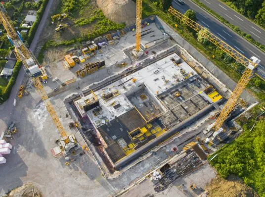
Developers use ALTA survey data to understand existing site conditions before committing to renovation, redevelopment, permitting, or design. A strong ALTA land title survey can support due diligence while providing useful information for future civil engineering, utility planning, and site development decisions.
Large Parcels & Land Acquisition
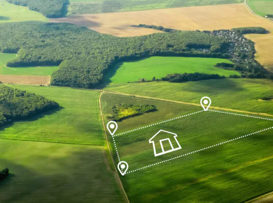
Large parcels often require deeper title research, careful boundary analysis, and thorough easement review. Projects such as a 96-acre ALTA survey in Kankakee County require disciplined field work and clear documentation so buyers and project teams can evaluate property constraints with confidence.
ALTA Survey Services Across Peoria & Davenport
Our ALTA survey services are supported by offices positioned to serve clients in Illinois and Iowa with consistent standards, local familiarity, and responsive communication.

-
Peoria, Illinois — Corporate Headquarters
311 SW Water Street, Suite 215
Peoria, IL 61602From our Peoria headquarters, Austin Engineering supports ALTA surveys across Central Illinois for commercial transactions, redevelopment projects, and property due diligence. Our long history in the Greater Peoria area gives our team familiarity with older parcels, complex subdivision records, and title research needs.
-
Davenport, Iowa — Branch Office
220 Emerson Place, Suite 101-A
Davenport, IA 52801Our Davenport office supports ALTA survey needs throughout Davenport, the Quad Cities, and surrounding Iowa communities. We coordinate with lenders, attorneys, title companies, and property stakeholders to support commercial closings, financing, permitting, and asset evaluation.
Why Austin Engineering for ALTA Surveys?
-

Defensible Survey Work Product
Boundary and title-related survey decisions must be supported by evidence, not assumptions. Our licensed surveyors apply careful research, field measurement, and professional analysis so your ALTA land title survey can withstand legal, lender, and technical review.
-

Strong Title & Table A Coordination
We confirm title commitment details, survey exceptions, and Table A selections early. This helps align buyers, lenders, attorneys, and title companies before the survey reaches final review.
-

Clear Deliverables for Decision-Makers
Our ALTA survey deliverables are prepared for the people who need to use them. Clean linework, readable legends, and organized documentation help owners, developers, attorneys, lenders, and title companies quickly understand key property conditions.
-

Proven Commercial Due Diligence Support
Since 1937, Austin Engineering has supported civil engineering and land surveying needs for public and private clients. With full-service land surveying capabilities, two full-time survey crews, and participation in organizations such as the Illinois Professional Land Surveyors Association and National Society of Professional Surveyors, our team brings both experience and professional accountability to ALTA survey work.
See What Our Clients Are Saying
“Austin Engineering is an excellent company. They are easy to communicate with and always deliver on time or even early. We use them for our ALTA Surveys and their detail is superior. The detail we get from Austin helps us in many ways. Their ALTA surveys provide important information for our permitting, renovation and overall understanding of the asset we are buying. Thank you Austin Engineering.”
“Austin Engineering has been wonderful to work with and is always reliable when needing to meet deadlines. The whole team works with you to keep projects (both big and small) on task. Communication with clients is a key factor they should pride themselves on.. since they never miss a beat. Thank you especially to Mike Cochran!”
Frequently Asked Questions About ALTA Surveys
An ALTA survey, also called an ALTA/NSPS land title survey, is a detailed survey prepared according to standards established by the American Land Title Association and the National Society of Professional Surveyors. It is commonly used in commercial real estate transactions.
An ALTA survey is often required for commercial property purchases, refinancing, title insurance, redevelopment, lender due diligence, or transactions where the buyer, lender, attorney, or title company needs detailed property documentation.
An ALTA survey may include boundary lines, easements, rights-of-way, access points, encroachments, improvements, visible utilities, title exceptions, and selected Table A items based on project requirements.
ALTA survey cost depends on property size, title complexity, Table A selections, site improvements, easement issues, utility verification, and transaction deadlines. A clear scope and complete title documents help improve cost predictability.
A boundary survey focuses primarily on property lines and corners. An ALTA survey includes boundary information plus additional title-related details needed by lenders, attorneys, title companies, and commercial buyers.
Table A items are optional survey items selected by the client, lender, attorney, or title company. These may include items such as flood zone classification, building height, parking counts, utility evidence, or other property details.
How ALTA Surveys Fit Into Your Land Surveying Plan
ALTA surveys are one component of our broader Land Surveying services and are often used alongside other survey deliverables during acquisition, design, permitting, construction, and closeout.
- Property Boundary Surveys: Resolve property lines through deed research, monument recovery, and professional boundary analysis.
- Topographic Surveys: Capture site elevations, improvements, utilities, and surface features for engineering and design.
- Construction Layout Surveys: Translate approved plans into accurate field layout for buildings, pavement, utilities, and infrastructure.
- Drone & Aerial Surveys: Collect aerial mapping data that supports planning, design, existing conditions review, and project documentation.
- FEMA Flood Elevation Surveys: Provide survey data for elevation certificates, floodplain review, and map amendment support.
- Solar Farm Surveys: Support renewable energy projects with survey data for large sites, access, boundaries, and construction coordination.
- Rural Farm Surveys: Help landowners, attorneys, and project teams document rural property boundaries, acreage, access, and land conditions.
For additional project support, Austin Engineering also provides Civil Engineering and Landscape Architecture services.
Ready to Move Your Survey Forward?
An ALTA survey should give every stakeholder the clarity needed to move forward with confidence. Whether you are preparing for closing, refinancing, permitting, renovation, or commercial property due diligence, Austin Engineering can help define the right scope and timeline.
Contact our Corporate Headquarters at 311 SW Water Street, Suite 215, Peoria, IL 61602 by calling (309) 315-3643 to discuss your ALTA survey needs, title requirements, and project goals.