
Our Boundary Survey Process
- Every boundary survey begins by defining why the survey is needed. The purpose may involve a real estate purchase, property sale, construction project, fence placement, subdivision, easement question, municipal requirement, legal review, or development planning. We also confirm the expected deliverables, which may include a survey map, property corner staking, legal description support, easement exhibits, or documentation for an attorney, title company, municipality, developer, lender, contractor, or property owner.
- Accurate boundary surveying starts with strong research. Our team reviews deeds, plats, legal descriptions, title documents, easements, rights-of-way, restrictions, and prior surveys when available. This record research establishes the legal framework for the property before field work begins. Older parcels, rural land, subdivisions, commercial properties, and tracts with multiple adjoining owners may require deeper document review to identify gaps, overlaps, or conflicting evidence.
- Field work confirms how record evidence relates to conditions on the ground. Our survey crews recover existing monuments, identify property corners, measure physical dimensions, and collect evidence that may affect the final boundary determination. This may include fences, walls, driveways, pavement edges, structures, apparent possession lines, and other improvements near the property limits. By comparing field evidence to record documents, we help identify encroachments or inconsistencies before they become larger problems.
- A land boundary survey is not simply a measurement exercise. Licensed surveyors must evaluate deed calls, monument evidence, occupation lines, adjoining parcels, recorded documents, and applicable surveying standards. Our surveyors apply professional judgment to reconcile the available evidence and prepare a defensible boundary determination. This level of analysis is especially important when a property has uncertain corners, older legal descriptions, adjoining improvements, or conflicting records.
- The final boundary survey deliverable must be clear, readable, and useful. We prepare maps and exhibits that identify property lines, corners, dimensions, easements, encroachments, improvements, and other relevant conditions. These documents help owners, attorneys, developers, lenders, contractors, and municipalities make informed decisions. When questions arise, our team responds efficiently so property transactions, permitting, design, or construction schedules can continue moving forward.
What’s Included in a Boundary Survey?
A boundary survey focuses on the legal and physical limits of a parcel. Depending on the property, records, and project needs, boundary survey services may include:
- Property line determination
- Property corner identification
- Monument recovery or monument placement
- Boundary retracement
- Deed and legal description review
- Easement and right-of-way review
- Encroachment identification
- Structures and improvements near boundary lines
- Fences, walls, driveways, pavement, or possession evidence
- Lot, tract, or rural farm boundary documentation
- Survey map or exhibit preparation
- Documentation for attorneys, title teams, owners, municipalities, or developers
A property boundary survey may be part of a broader property survey, but its primary purpose is to define the parcel’s legal and physical limits. That clarity helps protect ownership decisions, construction plans, access rights, and long-term property use.
What Impacts Boundary Survey Cost & Timeline?
Boundary survey cost depends on the property, record history, and level of documentation required. Key cost and schedule factors include:
- Property size, shape, and terrain
- Availability and quality of deeds, plats, or prior surveys
- Monument recovery difficulty
- Rural versus urban property conditions
- Easement and right-of-way complexity
- Number of adjoining parcels
- Possible encroachments or occupation conflicts
- Need for corner staking or added exhibits
- Attorney, lender, municipal, or title review needs
- Closing, permitting, development, or construction deadlines
Early communication helps define the right scope and reduce schedule surprises. When property records are complete and the desired deliverables are clear, the boundary survey process can move more predictably.
Residential, Commercial & Rural Boundary Survey Expertise
Austin Engineering provides boundary surveys for a wide range of property types and project needs.
Residential Boundary Surveys
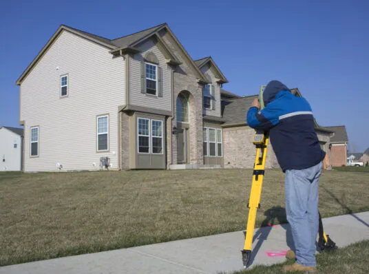
A residential boundary survey can help clarify property lines before a purchase, sale, fence installation, addition, driveway project, or neighbor concern. We identify property corners, easements, improvements, and encroachments so homeowners and project teams understand the limits of the parcel.
Commercial & Development Boundary Surveys
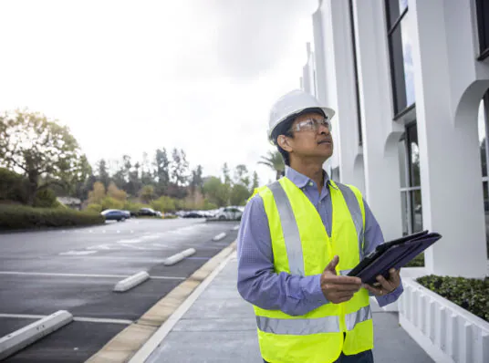
Commercial and development projects require defensible boundary information before site planning, financing, subdivision, redevelopment, or construction can move forward. Boundary survey work may support larger survey efforts for properties such as Peoria Urological Condominium, The Central Building Commercial Condominium, Twin Towers Condominium, and Prairie Lakes Apartments.
Large Parcels, Rural Land & Farm Surveys

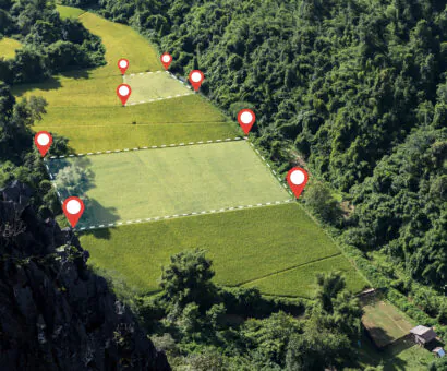
Large parcels and rural farm surveys often require extensive deed research, monument recovery, access review, and field coordination. Projects involving acreage, such as the 400 Acre Survey for Galena Gravel or the 500 Acre Land Survey in Henry, IL, require careful boundary analysis and clear documentation.
Boundary Survey Services Across Peoria & Davenport
Our boundary survey services are supported by offices positioned to serve Illinois and Iowa with consistent standards, local familiarity, and responsive communication.
-
Peoria, Illinois — Corporate Headquarters
311 SW Water Street, Suite 215
Peoria, IL 61602From our Peoria headquarters, Austin Engineering supports boundary surveys across Central Illinois for residential properties, commercial sites, rural acreage, subdivision work, and development projects. Our long history in the Greater Peoria area gives our team familiarity with older parcels, local subdivision patterns, and title research challenges.
-
Davenport, Iowa — Branch Office
220 Emerson Place, Suite 101-A
Davenport, IA 52801Our Davenport office supports boundary survey needs throughout Davenport, the Quad Cities, and surrounding Iowa communities. We assist property owners, developers, attorneys, municipalities, and project teams with boundary documentation tied to property decisions, development planning, and construction preparation.
Why Austin Engineering for Boundary Surveys?
-

Evidence-Based Boundary Decisions
Boundary decisions are driven by deeds, monuments, field evidence, record documents, and professional analysis. Our licensed surveyors evaluate the full picture before preparing a boundary determination.
-

Defensible Survey Documentation
Clear documentation helps reduce confusion for owners, attorneys, developers, lenders, and municipalities. Our maps identify property lines, easements, encroachments, restrictions, and relevant improvements in a format designed for practical decision-making.
-

Experienced Survey Crews
Austin Engineering has provided civil engineering and land surveying services since 1937. With full-service land surveying capabilities and two full-time survey crews, our team understands how to balance field accuracy, document review, and schedule needs. Our survey work is also supported by professional involvement with organizations such as the Illinois Professional Land Surveyors Association and the National Society of Professional Surveyors.
-

Coordination With Broader Project Needs
Boundary surveys often support legal descriptions, site planning, construction, easement work, and engineering design. When appropriate, our survey team works alongside Austin Engineering’s civil engineering and landscape architecture teams to keep project information aligned.
See What Our Clients Are Saying
“The Austin Engineering team was exceptional to work with, specifically Mike & Jerrod. Despite being during the holiday season, they prioritized my request and completed the survey and relevant documentation timely allowing me to close my property purchase. Their professionalism and expertise is much appreciated.”
“Justin was very helpful, kind and extremely informative! Highly recommend this group if you need any surveyor needs
Frequently Asked Questions About Boundary Surveys
A boundary survey determines the legal limits of a property by reviewing records, locating physical evidence, recovering monuments, and applying professional boundary analysis.
You may need a boundary survey before buying or selling property, building improvements, installing a fence, subdividing land, resolving a property line question, or preparing for development.
Boundary survey cost depends on property size, record availability, monument recovery, easement complexity, terrain, deliverables, and schedule requirements.
A boundary survey focuses on property lines and corners. An ALTA/NSPS land title survey includes boundary information plus expanded title, lender, easement, access, improvement, and due diligence details for commercial transactions.
Yes. A boundary survey can show observed improvements or conditions that cross, touch, or affect property lines, such as fences, driveways, walls, buildings, or pavement.
Yes, property corner marking or staking can be included in the survey scope when requested and appropriate for the project.
How Boundary Surveys Fit Into Your Land Surveying Plan
Boundary surveys are one component of our broader Land Surveying services and often support acquisition, development, legal review, construction, and project documentation.
- ALTA/NSPS Land Title Surveys: Provide title-driven survey documentation for commercial property transactions, lenders, attorneys, and title companies.
- Topographic Surveys: Capture site elevations, improvements, utilities, and surface features for engineering and design.
- Drone & Aerial Surveys: Collect aerial mapping data for planning, large sites, existing conditions review, and documentation.
- Construction Layout Surveys: Translate approved plans into field layout for buildings, pavement, utilities, and infrastructure.
- FEMA Flood Elevation Surveys: Provide elevation data for floodplain documentation, elevation certificates, and map amendment support.
- Solar Farm Surveys: Support renewable energy projects with survey data for large sites, access, boundaries, and construction coordination.
- Rural Farm Surveys: Help landowners and project teams document rural acreage, access, property limits, and land conditions.
For additional project support, Austin Engineering also provides Civil Engineering and Landscape Architecture services.
Ready to Move Your Survey Forward?
A boundary survey gives you the property clarity needed to make confident decisions before buying, building, dividing, improving, or developing land. Whether you need to confirm property corners, address an easement question, prepare for a closing, or support a larger development plan, Austin Engineering can help define the right survey scope for your next step.
Contact our Corporate Headquarters at 311 SW Water Street, Suite 215, Peoria, IL 61602 by calling (309) 315-3643 to discuss your boundary survey needs, timeline, and project goals.