Why Industry Leaders Choose Us
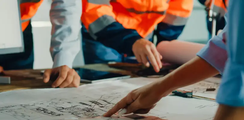
- Constructability as a Standard: We engineer for real-world application. By designing to actual equipment tolerances and field sequencing, we significantly reduce RFIs and change orders.
- Predictable Schedules: Time is capital. We deliver complete, reviewer-ready submittals and maintain rigorous correspondence to keep permits moving through the pipeline.
- Cost-Aware Engineering: We optimize lifecycle costs through balanced cut/fill strategies, right-sized detention systems, and practical material selection.
- Integrated Project Delivery: Our Civil, Survey, and Landscape teams collaborate daily, not just at milestones. ADA routes align seamlessly with grading; utilities respect critical root zones; and survey control is maintained from initial staking to final as-builts.
- Professional Credibility: Our team maintains active leadership in AWWA, ISPE, NSPE, ISPLS, and ISPLA, ensuring every project benefits from current industry standards.
Our Core Services
Civil Engineering
Buildable Plans. Predictable Timelines. Real-world Performance.
We manage the full site lifecycle: site planning, stormwater management, grading/earthwork, utilities and infrastructure, permitting & compliance, construction documents, and construction-phase support.
- Primary Sectors: Developers, Municipalities, Healthcare/Education, Industrial/Logistics, Mixed-Use, Residential.
- The Outcome: Minimized RFIs, competitive bids, and accelerated approvals.
Landscape Architecture
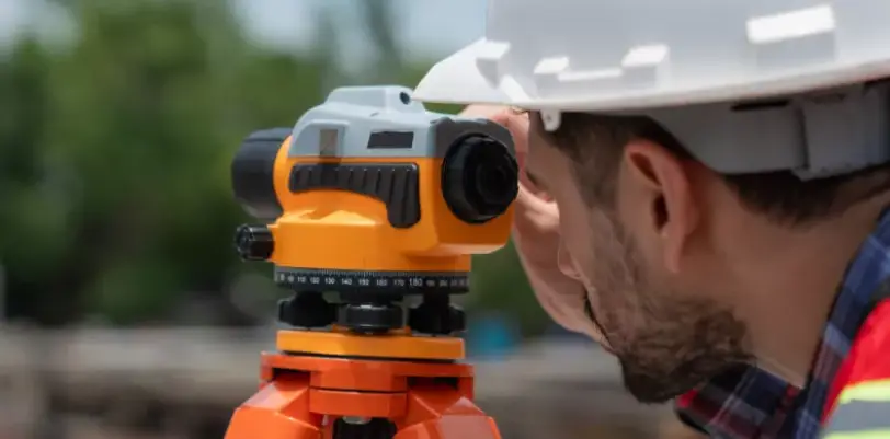
Accurate Data. Defensible Maps. Confident Decisions.
We provide comprehensive survey services including ALTA/NSPS with Table A, boundary/retracement, topographic mapping, construction staking, plats/easements, elevation certificates & LOMA/LOMR, and as-builts/record drawings. Note: We offer statewide survey capabilities across Iowa via our Davenport office.
- Key Deliverables: Precision plats (PDF), CAD/DWG, surface models, point files, and legal exhibits.
- The Outcome: Defensible, high-accuracy documents for lenders, attorneys, engineers, and contractors.
Landscape Architecture
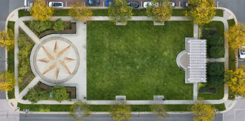
Functional Spaces. Sustainable Design. Enduring Value.
We deliver site planning and circulation, native-focused planting, streetscapes & public realm design, plazas & amenity areas, trail connectivity, and green infrastructure (permeable paving/bioretention/tree trenches). We produce coordinated construction documents with clear maintenance guidance. (Delivered from our Peoria HQ)
- Design Focus: User comfort, ADA compliance, maintenance reality, and stormwater synergy.
- Outcome: Outdoor environments engineered to perform on day one—and year ten.
Determining the Right Path for Your Project
- Closing or Financing: Requires Land Surveying (ALTA/NSPS) with selected Table A items.
- Initial Site Layout / Entitlement: Requires Civil Engineering for concept modeling, grading, utilities, and stormwater analysis.
- Construction Sequencing / RFIs: Requires Civil + Survey (Construction staking, RFI management, As-builts).
- Public-Facing Space / User Experience: Requires Landscape Architecture (ADA routing, shading, furnishing, planting plans).
- Complex Stormwater Challenges: Requires Civil Engineering (Detention/Outfalls) integrated with Landscape Architecture (Bioretention/Permeable infrastructure).
Unsure of your scope? Define your goal, site, and timeline. We will engineer the precise scope required—no more, no less.
Regional Operations
- Peoria, IL: Civil Engineering, Land Surveying, Landscape Architecture
- Davenport, IA: Civil Engineering & Land Surveying (Statewide Surveying).
- Chattanooga, TN: Civil Engineering
Licensed states: IL, IA, WI, IN, FL, NC, TX, TN, GA, KS, LA, MO, OH, SC, CO, AL.
Integrated Services in Action
The Foundry Shopping Center - Bloomington, IL
Our Civil and Landscape teams collaborated to transform a former industrial site into a pedestrian-friendly retail hub. The solution integrated permeable paving, native plantings, and seamless trail connections to the Constitution Trail.
Industries We Serve
Commercial & Mixed-use Retail centers, restaurants, and outlot developments
Industrial & Logistics Heavy-duty pavement design and optimized truck circulation
Municipal & Public Streetscapes, civic sites, and drainage infrastructure upgrades
Healthcare & Education Safe access planning, wayfinding, and phased construction
Residential & Community Subdivisions, urban infill, and HOA standard compliance
Ready to Move Forward with Your Project?
Request a Proposal — Share your site parameters, goals, and timeline. We will outline the scope, deliverables, and schedule required for success.
Contact Our Regional Offices:
- Peoria (309) 315-3643
- Davenport (563) 207-4605
- Chattanooga (423) 379-2725
FAQs
Yes. We scope Civil, Surveying, or Landscape independently to suit project needs—however, our internal integration ensures seamless coordination should you choose to bundle services later.
Boundary/Topo: Typically 1–3 weeks. ALTA: 3–6+ weeks, dependent on title work and Table A requirements. Civil Concept-to-Permit: 6–10 weeks, contingent on project complexity and regulatory review windows.
That is our primary objective. We prioritize constructability, rigorous labeling, and rapid RFI responses to shorten bid cycles and maintain field momentum.
Yes. We attend plan commission, council, and neighborhood meetings. We prepare professional exhibits and handle all technical inquiries to support your entitlement process.